UNA SUZUKI VSTROM 650 Y UN CASCO SHARK EVOLINE III RECORRIERON LAS 7 ISLAS CANARIAS EN 3 DIAS Y MEDIO.
Un total de 1639km, 88 poblaciones, 7 islas y 12 barcos fue la hazaña realizada por una Suzuki Vstrom 650 y un casco Shark Evoline III, con el apoyo de Naviera Armas.
Siguiendo los pasos del equipo de "Canarias en moto" pionero en esta travesía que la realizaron en el 2013 recorriendo nuestro archipiélago en siete días un total de 12 motociclistas. Ahora el reto era en la mitad de tiempo y en solitario. Sólo una Suzuki y un casco Shark.
Debido a la complejidad del viaje hubo que realizar una planificación muy estricta sin dejar ningún detalle al azar. Hoteles, billetes de barco, rutas marcadas en el GPS y un sin fin de temas necesarios para cumplir la aventura con éxito.
Con tal limitación de tiempo, las fotos que demostrarían el viaje había que hacerlas desde la moto en marcha. Muy poquitas se hicieron con la moto parada. En dicha planificación, lo que más tiempo llevo fue la programación del GPS con las rutas escogidas en cada isla. Había que recorrerlas pasando por todos los municipios en el mínimo tiempo posible y con la ruta más corta.
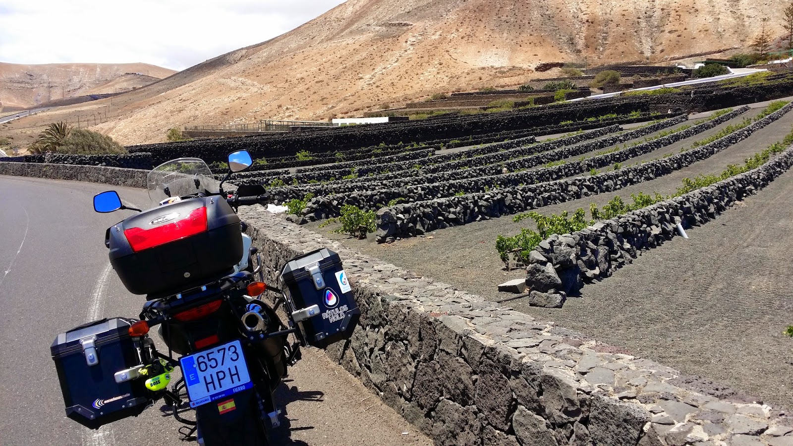
Antes de comenzar la aventura, hubo que realizar una minuciosa revisión a la moto, así como terminar de instalarle los accesorios necesarios para el viaje: control de crucero, GPS y soportes para la cámara.
El estress y el tiempo me obligaron a pedir ayuda a mi gran amigo Fran. Gran experto en preparación de motos a última hora. Recordamos hace ya 4 años cuando me ayudó con la preparación de la moto para la travesía americana, en aquel entonces me echo una mano al romperme el brazo.
Wednesday, June 18, 2014
Motorcycle Canary Islands: 3 days and a half
A
VSTROM 650 SUZUKI AND A HELMET SHARK EVOLINE III toured the seven
CANARY ISLANDS IN A PERIOD OF 3 DAYS AND A HALF. A total of 1639km, 88
populations, 7 islands and 12 boats was the feat accomplished by a
Suzuki Vstrom 650 and Shark Evoline helmet III with the support of
Naviera Armas.
Following in the footsteps of the team
"Canarias en moto" which is the pioneer in this journey that made the
2013 touring in our islands in seven days with a total of 12 riders. Now
the challenge was to do it in half the time and going solo. With a
Suzuki and a Shark helmet.
Due to the complexity of the trip we had to make a very strict
plan, leaving no detail to chance. Hotels, airplane, boat routes all
marked on the GPS and a myriad of topics necessary to meet the adventure
successfully.
With such limited time, the photos that will demonstrate the
journey had to be done while the bike was running. We took very few
pictures while the moto was at a stop. In this planning, what took more
time was programming the GPS with routes chosen on each island. You had
to roam through all the municipalities in the shortest amount of time
and with the shortest route.
Before starting the adventure, we had to
conduct a thorough review on the bike and finish putting on the
accessories needed for the trip: cruise control, GPS and camera holders.
The stress and time forced me to seek the help from my good friend
Fran, a great expert in preparation of bikes at the last minute. We
remembered it was 4 years ago when he helped me with the preparation of
the bike for the American journey, at that time I needed a helping hand
because I had a broken arm.

Por cuestiones de horarios de los barcos, la aventura hubo que planearla para comenzar en las islas peor comunicadas: La Palma y el Hierro. Ambas islas se encuentran en el oeste del archipiélago.
Based on the different schedules of the boats, we need it to
plan this adventure to start at the islands with worse communication:
La Palma and El Hierro. Both islands are located in the west of the
archipelago.

Comenzó la aventura...
- Punto de partida: Isla de La Palma.
- Fecha y hora de salida: día 5 Junio 00:05
- Marcador kilómetros moto: 2.474km
The adventure begins ...
Starting point: Island of La Palma.
Date and time of departure: 00:05 on June 5th
Mile marker on the bike: 2.474km


Arrancaba motores justamente en el comienzo del día 5 de Junio. Recorrer La Palma en la madrugada es una tarea nada fácil y además cansada. Tras los primeros kilómetros dirección norte, llegaba la neblina, el frío y la carretera mojada. Puntagorda, Garafía y Barlovento fueron "complicados". Ya en la vertiente este, desde Los Sauces a Fuencaliente la carretera seca y buena visibilidad. El resto de la isla, desde Fuencaliente a Los Llanos y luego a Santa Cruz de La Palma también tranquilo. Algunas obras que se realizan en la carretera ralentizaban el viaje debido a la arenilla de la vía.
Tras La Palma, barco a la isla de Tenerife donde el marcador de la moto indicaba 2.693km.
Tenerife, isla fácil para recorrer comenzaba el recorrido a las 8.30am. La estrategia programada en el GPS marcaba rodear la isla haciendo 3 desvíos para acceder a poblaciones fuera de la red principal del anillo insular. Destacar el viento en el trayecto de Candelaria a Los Cristianos y las malas condiciones de la carretera entre Los Cristianos y El Tanque.
Engines tore from the very beginning of June 5.
Going
through La Palma in the middle of the night is not an easy task and also
tiring. After the first few miles going north, the fog came, the road
was wet and cold. Puntagorda, Garafia and Barlovento were "complicated"
routes. On the eastern side, from Los Sauces Fuencaliente we had dry
roads and good visibility. The rest of the island, from Los Llanos
Fuencaliente and then to Santa Cruz de La Palma was also quiet. Some
construction work took place out on the road so it slowed the trip
down.
Right after La Palma, the boat that goes to the island of Tenerife, the marker was indicating that the bike went 2.693km.
Tenerife,
was easy to navigate through. The island tour started at 8.30am. The
strategy programmed into the GPS marked around the island made us take 3
detours to access three locations off the main island. I highlight the
strong winds on the way from Candelaria to Los Cristianos and the poor
conditions of the road between Los Cristianos and El Tanque.

Cinco de la tarde, barco destino El Hierro. Marcador de kilómetros indicaba 3.028km
Arrancaba la aventura herreña a las 8:30pm con el sol amenazando en el horizonte.
Five o'clock in the afternoon. Next destination, El Hierro. The mile marker was indicating 3.028km on the bike.The adventure starts at 8:30pm with the sun threatening on the horizon.

Asfalto perfecto, señalización de las carreteras muy claras y el GPS indicaba El Pinar para luego pasar la noche en la Restinga.
Perfect Asphalt, signaling clear on the roads and the GPS indicated we were at El Pinar, to then later spend the night at the Restinga.

Ya en la madrugada, maletas cargadas y la Suzuki recorría las carreteras dirección Frontera.
Very early in the morning, suitcases loaded, Suzuki on the road and on our way to the border.

Poco más tarde daba por concluida el recorrido de El Hierro en su capital: Villa de Valverde.
Later that day we were at the end of the route of El Hierro in it's capital: Villa de Valverde.
Five o'clock in the afternoon. Next destination, El Hierro. The mile marker was indicating 3.028km on the bike.The adventure starts at 8:30pm with the sun threatening on the horizon.
Asfalto perfecto, señalización de las carreteras muy claras y el GPS indicaba El Pinar para luego pasar la noche en la Restinga.
Perfect Asphalt, signaling clear on the roads and the GPS indicated we were at El Pinar, to then later spend the night at the Restinga.
Ya en la madrugada, maletas cargadas y la Suzuki recorría las carreteras dirección Frontera.
Very early in the morning, suitcases loaded, Suzuki on the road and on our way to the border.
Poco más tarde daba por concluida el recorrido de El Hierro en su capital: Villa de Valverde.
Later that day we were at the end of the route of El Hierro in it's capital: Villa de Valverde.

Tercer barco y esta vez dirección Tenerife, una breve estancia allí y cuarto barco esta vez a La Gomera.
Comenzaba la ruta de la Gomera con 3.193km ya bastante avanzada la tarde.
The third boat and this time the destination being Tenerife, a short stay here and from there to the fourth boat to La Gomera. The route began with 3.193km later in the afternoon.

El GPS marcaba ruta por Valle Gran Rey que obligaría a bajar a la costa y volver a subir a la vía principal.
The GPS marked the route to the Valle Gran Rey, which forced me to go down to the coast and back up to the main road.

Carreteras perfectas, curvas divertidas pero la noche se echó encima.
Perfect roads, fun curves then the night fell upon us.

Al terminar la isla colombina, el marcador de kilómetros indicaba 3.404km. Más de la 1am, era hora de descansar...
After we completed the Colombina island the mile marker indicated 3.404km. It's passed 1am, time to take a break. ...
The third boat and this time the destination being Tenerife, a short stay here and from there to the fourth boat to La Gomera. The route began with 3.193km later in the afternoon.
El GPS marcaba ruta por Valle Gran Rey que obligaría a bajar a la costa y volver a subir a la vía principal.
The GPS marked the route to the Valle Gran Rey, which forced me to go down to the coast and back up to the main road.
Carreteras perfectas, curvas divertidas pero la noche se echó encima.
Perfect roads, fun curves then the night fell upon us.
Al terminar la isla colombina, el marcador de kilómetros indicaba 3.404km. Más de la 1am, era hora de descansar...
After we completed the Colombina island the mile marker indicated 3.404km. It's passed 1am, time to take a break. ...

Tras la noche en La Gomera y ya muy temprano en la mañana, barco a Tenerife y luego barco a Gran Canaria. Sería el sexto barco en el trayecto.
After the night in La Gomera and already very early in morning we
took the boat to Tenerife and then to the Gran Canaria. This would be
the sixth ship we take..

Arrancaba el recorrido en la isla de Gran Canaria. La isla quizás más complicada de recorrer debido a la complejidad de sus trazados. El GPS marcaba la ruta más fácil al comienzo, consistía en rodear la isla. Todo perfecto desde Agaete a Las Palmas y después hasta Mogán. Pero Gran Canaria nos tenía una sorpresa guardada... el trayecto Mogán Agatete. Quinientas? Mil? quizás dos mil curvas!!!! Impresionante ese trayecto por su belleza en paisajes, dificultad en trazados y divertida por sus curvas.
I started the tour on the island of Gran Canaria. Perhaps the most difficult island to travel due to the complexity of their paths. The GPS showed the easiest route at the beginning, it consist in surrounding the island. Everything went perfect from Agaete to Las Palmas and then to Mogan. But the Gran Canaria had a hidden surprise waiting for us... the road Agatete Mogan! Five hundred? Thousand? perhaps two thousand curves!! Impressive journey for her beauty and scenery, difficult for it's layouts and fun for it's curves.

Aunque la Suzuki volaba, los moteros de la zona volaban más... imposible seguirles el paso. Puedo asegurar que hemos estado en el "Gran Cañón del Colorado canario"!!!!
Although the Suzuki flew, the bikers from the area went even faster ... impossible to keep up. I can assure you that it seems like we have been in the "Grand Canyon of the canary Colorado"!!!
I started the tour on the island of Gran Canaria. Perhaps the most difficult island to travel due to the complexity of their paths. The GPS showed the easiest route at the beginning, it consist in surrounding the island. Everything went perfect from Agaete to Las Palmas and then to Mogan. But the Gran Canaria had a hidden surprise waiting for us... the road Agatete Mogan! Five hundred? Thousand? perhaps two thousand curves!! Impressive journey for her beauty and scenery, difficult for it's layouts and fun for it's curves.
Aunque la Suzuki volaba, los moteros de la zona volaban más... imposible seguirles el paso. Puedo asegurar que hemos estado en el "Gran Cañón del Colorado canario"!!!!
Although the Suzuki flew, the bikers from the area went even faster ... impossible to keep up. I can assure you that it seems like we have been in the "Grand Canyon of the canary Colorado"!!!

Tras la circunvalación a Gran Canaria comenzaba la parte mas "enredada". Poblaciones como Firgas, Moya, Teror, San Bartolomé, Santa Brígida, Telde... eran un "entra y sale" a barrancos, trazados sinuosos y estrechos con el peligro de los "turistas aventureros" que andaban perdidos por la zona...
After the encirclement to Gran Canaria was the most confusing part of the road. Small towns like Firgas, Moya, Teror, San Bartolomé, Santa Brigida, Telde ... they were "in and out" with narrow winding paths with the danger of the "adventure tourists" who were lost in the area ...


El GPS nos guió perfectamente por todos esos trazados y tan solo el cronómetro era nuestro enemigo. Siempre vigilando la hora estimada de llegada para no perder el barco a la siguiente isla.
The GPS guided us perfectly for all those paths and only the clock was our enemy. Always monitoring the time so we don't miss the boat that will take us to the next island.
The GPS guided us perfectly for all those paths and only the clock was our enemy. Always monitoring the time so we don't miss the boat that will take us to the next island.
Barco a Fuerteventura. Noche en Morrojable y ya muy temprano en la mañana, día 8 de Junio, comenzaba la travesía.
We took the boat to Fuerteventura. We spent the night in Morrojable and already very early in the morning, on June 8th, the travesty begins.

Con carreteras casi rectas y muy poco tráfico, las velocidades eran muy superiores al resto de las islas. Municipio tras municipio, en pocas horas nos encontrábamos en Corralejo esperando barco hacia Lanzarote, nuestra última isla.
With nearly straight roads and very little traffic, the speed was much higher than the other islands. Town after town, within a few hours we were in Corralejo waiting for the boat to Lanzarote, our last island.
We took the boat to Fuerteventura. We spent the night in Morrojable and already very early in the morning, on June 8th, the travesty begins.
Con carreteras casi rectas y muy poco tráfico, las velocidades eran muy superiores al resto de las islas. Municipio tras municipio, en pocas horas nos encontrábamos en Corralejo esperando barco hacia Lanzarote, nuestra última isla.
With nearly straight roads and very little traffic, the speed was much higher than the other islands. Town after town, within a few hours we were in Corralejo waiting for the boat to Lanzarote, our last island.


En poco más de media hora comenzaba la última travesía de este reto. Lanzarote!!!
in just over half an hour started the last travesty of this challenge. Lanzarote!
in just over half an hour started the last travesty of this challenge. Lanzarote!

El GPS marcaba ruta directamente a Orzola.
The GPS marked the route directly to Orzola.

Carreteras espectaculares aunque con mucho viento. Poco tránsito y todo muy bien indicado.
Great roads although it was very windy. Little traffic and all beautifully displayed.
Sin darnos cuenta cruzamos el último municipio y ya solo quedaba la última foto del viaje. La foto de "prueba conseguida". Eran las 11:51am.
Without realizing it, we crossed the last municipality and it was only the last picture of the trip. The photo that shows "we got proof of." It was 11:51 a.m..

El marcador de kilómetros indicaba 4.008 km. Habíamos recorrido las 7 islas Canarias en menos de tres días y medio, un total de 88 poblaciones y 1.534km.
The mile marker indicated 4,008 km. We had traveled the 7 Canary Islands in less than three and a half days, a total of 88 small towns and 1.534km.
The mile marker indicated 4,008 km. We had traveled the 7 Canary Islands in less than three and a half days, a total of 88 small towns and 1.534km.

Ahora solo faltaba la vuelta a casa que terminaría con el recorrido de casi 2000km y 12 barcos utilizados para los desplazamientos
Según fuentes consultadas, la Suzuki llevaba un tipo sobre ella. Debe haber sido un tipo muy pequeño porque sólo se veía el casco Shark y poco más... :)
Cuando la gente me pregunta que cuánto me costó este viaje tan intenso, siempre les digo que tengo que esperar al mes próximo a que me lleguen todas las multas por exceso de velocidad....
La mayoria de personas que leen esta noticia o se enteran de la aventura, sólo ven el record conseguido. El jueves 5 de Junio cuando comenzaba la travesía, lo que menos me preocupaba era si conseguiría o no conseguiría el record. Yo simplemente iba buscando una buena prueba para la moto y para mi, de cara al gran viaje que comenzaremos muy pronto... El resultado fue perfecto. Algunos detalles a modificar en la moto y sobre todo, darme cuenta que aún puedo dar la talla en cuanto al viaje...
Anécdota: estuve alimentándome durante 3 dias y medio en los barcos, excepto 1 desayuno y 2 cenas. El resto en las cafeterias atendidos por marineros/camareros...
Now the only thing
left to do was to go back home. This would conclude with the route of
almost 2000km and 12 boats used for commuting
According to
sources, the Suzuki had a guy on it. It must have been a very small dude
because we could only tsee he Shark helmet and a little more ... :)
When
people ask me how much it costed me to fund this intense trip, I always
tell them that I have to wait until next month till I get all my
speeding tickets so I can be able to do the math....
Most
people who read or hear this story of adventure, only managed to see
the record I have achieved. On Thursday June 5th, when the journey
began, the last thing I cared about was whether or not to get a record. I
was just looking for a good test for the bike and me. The result was
perfect, there are only a few details I need to modify on the bike. But
overall I realized I can still make it in terms of travel ...
Anecdote:
For the past 3 days and a half I've been eating on boats, except for 1
breakfast and 2 dinners. The rest were in the cafeterias served by
sailors / waiters ...